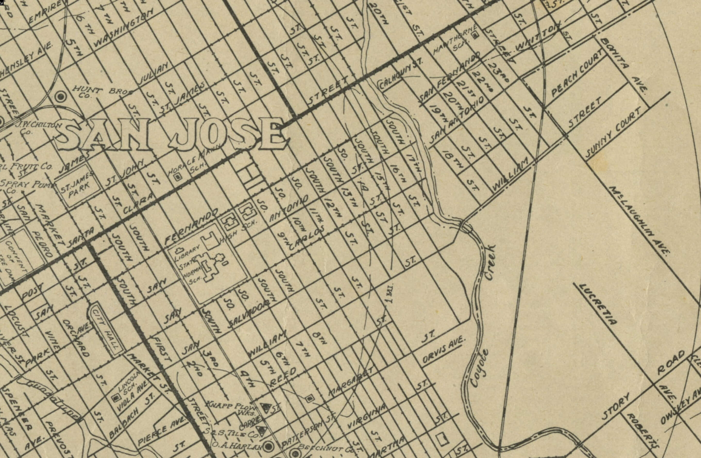
1904 San Jose Map
First San Jose map found after the start of the Naglee Park building. The map incorporates Survey No. 1.
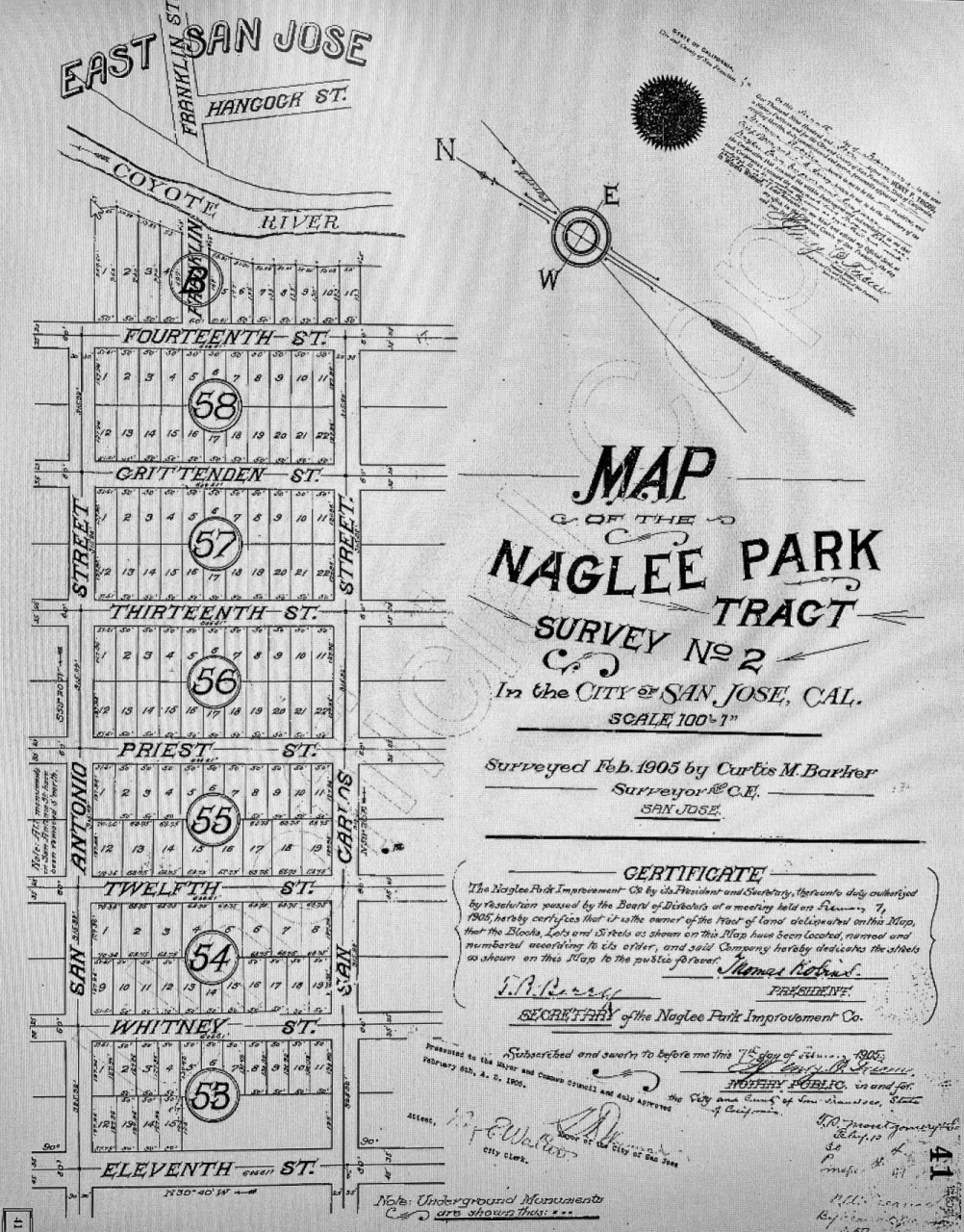
1905 Naglee Park Survey Map 2
Here is the official survey map for the second set of Naglee Park lots. It’s dated February 1905, but the San Francisco earthquake hit on Apr 18, 1906, so it had a effect on house building. The earliest houses from this lot start in 1907.
Note that Block 53 has missing lots. As the above maps illustrates, the NPIC did not have this land to sell.
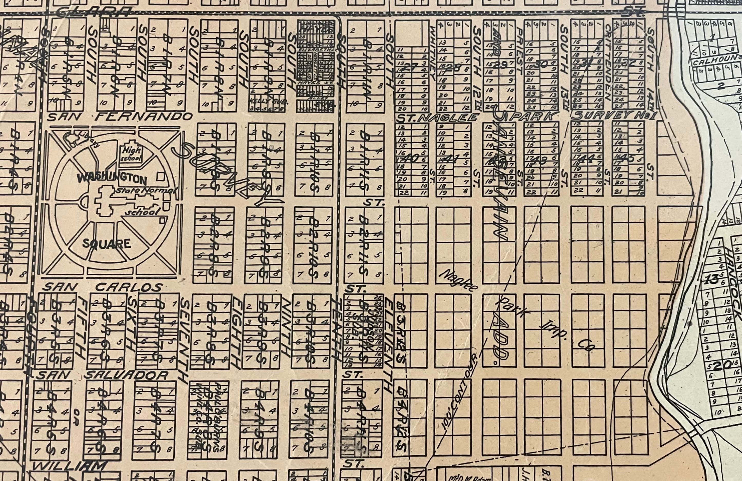
1906 Map of San Jose
Shows the progress of the Naglee Park develop. Survey maps had been granted up to San Carlos – up to the second Survey
1906 Photo of San Jose including view of Naglee Park
Outline of Naglee Park marked by red dots. San Jose Normal School with blue dot. Hoffman mansion with green dot. Naglee house with purple dot.
1909 San Jose Tax Map
This map is important because it shows who owned the property, and paid tax on the property in 1909.
Notice that some properties were changes borders slightly
1915 Sanborn Fire Map
Created across the county by the Sanborn company to help insurance providers to establish fire insurance rates. The map shows an accurate outline of the properties at the time of 1915. This particular version of the map was stitched together to show the entirety of Naglee Park. The piece of the Sanborn Map can be found here:
1921 San Jose Map showing Naglee Park
At this point forward, the maps have become less informative.